Unlocking Subsurface Data
Recent developments in full wavefield recording devices, higher resolution equipment and advances in data processing has enabled Echo Geotechnical to develop a low cost, non-intrusive shear source towing a series of equally spaced component receivers.
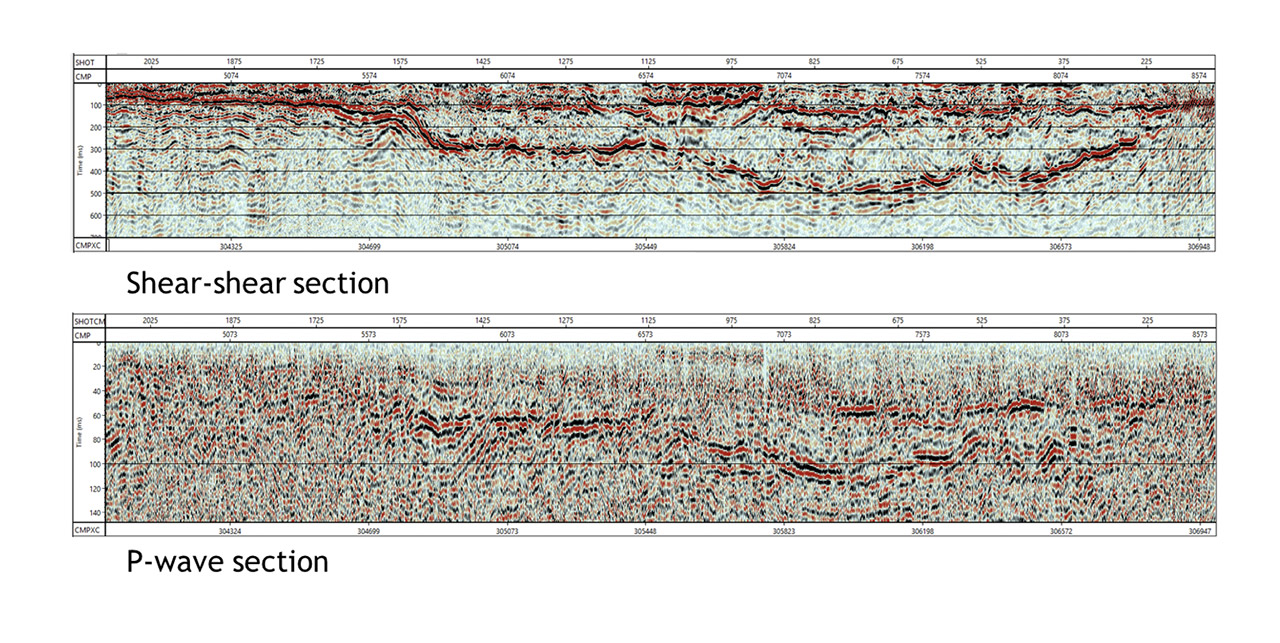
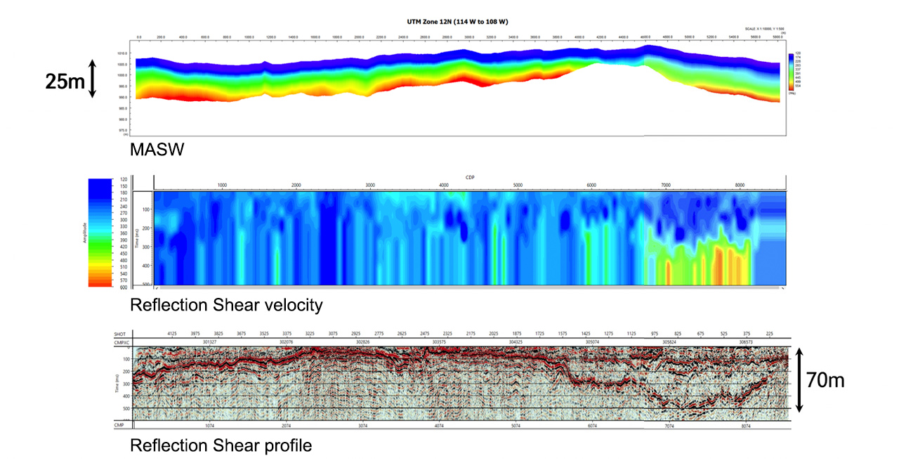
This new configuration facilitates acquisition of continuous lines of data of the near surface soils using MASW processing (<6m) while at the same time acquiring shear-wave reflection AND P-wave reflections data. This system is capable of continuously acquiring accurate data within the range of 0-200m depth at a rate of 1 km/day with a small crew.
Acquisition Technology
We use a cutting-edge combination of proven seismic equipment and new technology to create detailed images of the ground, up to 200 meters deep.
Our Competitive Edge
You get high-resolution pictures with real-time GPS tracking for pinpoint accuracy. Our system efficiently collects multiple types of data in one pass, saving you time and money.
Plus, it’s non-intrusive, making it perfect for cities or sensitive areas like dams. Finally, our fast on-site processing lets you see the results and adapt your plans immediately.
Survey Integration
Our Technology
- Realtime GPS with decimeter accuracy for timing, equipment positioning and data recording
- Integration with Vibroseis electronics
- Roving survey packs allow accurate positioning of our data recording and tying into key on-site engineering elements such as drill holes, surface infrastructure and/or hazards
Our Competitive Edge
- Improved accuracy in data and key element positioning means a reduced amplification of errors in data processing, and avoids degradation of the final interpretation
- Real-time positioning allows rapid integration of geological learnings while in the field
Processing Methodology
Our Methodology
- Adapt sophisticated oil Industry standard processing algorithms to near surface profiles
- Algorithms specifically designed to seamlessly manage the output data records from the newly developed land streamer
- Full wave form processing including Shear wave (MASW and SH-wave reflection) and Compression or P-wave data
Our Competitive Edge
- Rare depth of experience processing near surface reflection data as well as high resolution 3D oil industry data volumes
- Oil industry standard processing algorithms deliver superior results to simpler engineering processing software
- High resolution imaging in low velocity soils
- Shear modulus estimates delivered for engineering analysis
- Final results often available within 24 hours to enable important timely decisions in the field
Interpretation Deliverables
Our Methodology and Deliverables
- Oil Industry standard seismic interpretation software has been modified for geotechnical applications:
- Well spots, logs and soil types can be integrated with the seismic profiles to tie the profiles to drill or CPT locations.
- Horizons or lithologic boundaries are interactively “picked” along the profiles and can be exported as ASCII or excel databases.
- Seismic times can be converted to depth and contours can be generated for each layer that tie the drill logs.
- Velocity sections are generated and overlaid on the seismic profiles to identify layer characteristics
Our Competitive Edge
- Oil industry standard deliverables ready for integration to geotechnical workflows including:
- Stratigraphic and structural profiles validated with available well and CPT data
- Lithologic horizons ready for integration with other engineering datasets
- Velocity sections overlain on seismic profiles for geotechnical or hydrogeological modeling
- Estimates of engineering parameters such as shear modulus
- Quickly identify subsurface features such as tunnels, fluids, low shear strength materials and buried channels